Land off Holyhead Road
Wellington
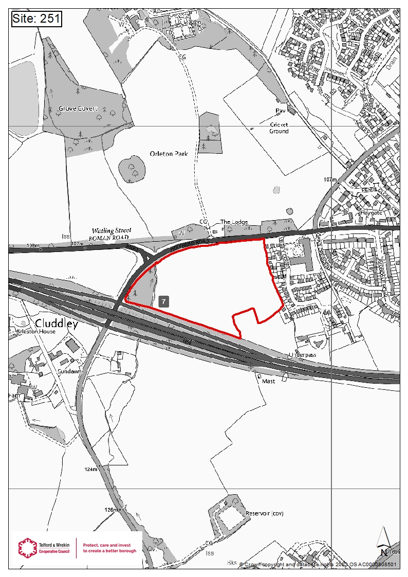
The Site
The proposed Site comprises 7.3 hectares of arable farmland, located to the south west of Wellington and is enclosed by Holyhead Road to the north and west, residential development to the east and the M54 to the south. Within the site, the western boundary consists of a woodland and watercourse.
The Site is located adjacent to the Wellington settlement boundary, with existing access to the B5061 (Holyhead Road). Wellington forms one of the District’s seven centres within which a range of commercial facilities, shops, restaurants and pubs, banks and a market are conveniently located.
The Site’s proposed access is located approximately 430m from junction 7 of the M54 along Holyhead Road providing connection to the wider road network.
The Site is well-served by a range of public transport with the nearest bus stop located approximately 200 metres to the east of the site access along Holyhead Road serving routes 101, x11 and x12 providing connections to Wellington, Shrewsbury, Telford and Newport. The nearest train station is Wellington train station located approximately 1.65 km to the north east of the Site, which is accessible via bus. Wellington train station provides regular connections to Birmingham, Wolverhampton, Shrewsbury and Aberystwyth.

Site Location Plan
Click image to enlarge
Planning Policy

Click image to view more
Click image to enlarge
The site is a draft housing allocation (Ref: 251) as identified in the Telford and Wrekin Local Plan Review 2020-2040 and the supporting policies map as illustrated adjacent.
Policy Strategic S4 (Housing delivery strategy) of the Local Plan Review outlines that housing development will be supported and delivered through the allocation of new housing sites as shown on the Policies Map and in accordance with Policy HO1 (Housing development principles).